What makes a good street?
Pedestrianisation schemes are a way to reallocate streetspace away from vehicle traffic. But how do these spaces function, and how do they impact the city?A summary of dissertation research submitted to the UCL Bartlett School of Planningby Jack Staid
Background
Case studies
Conclusions
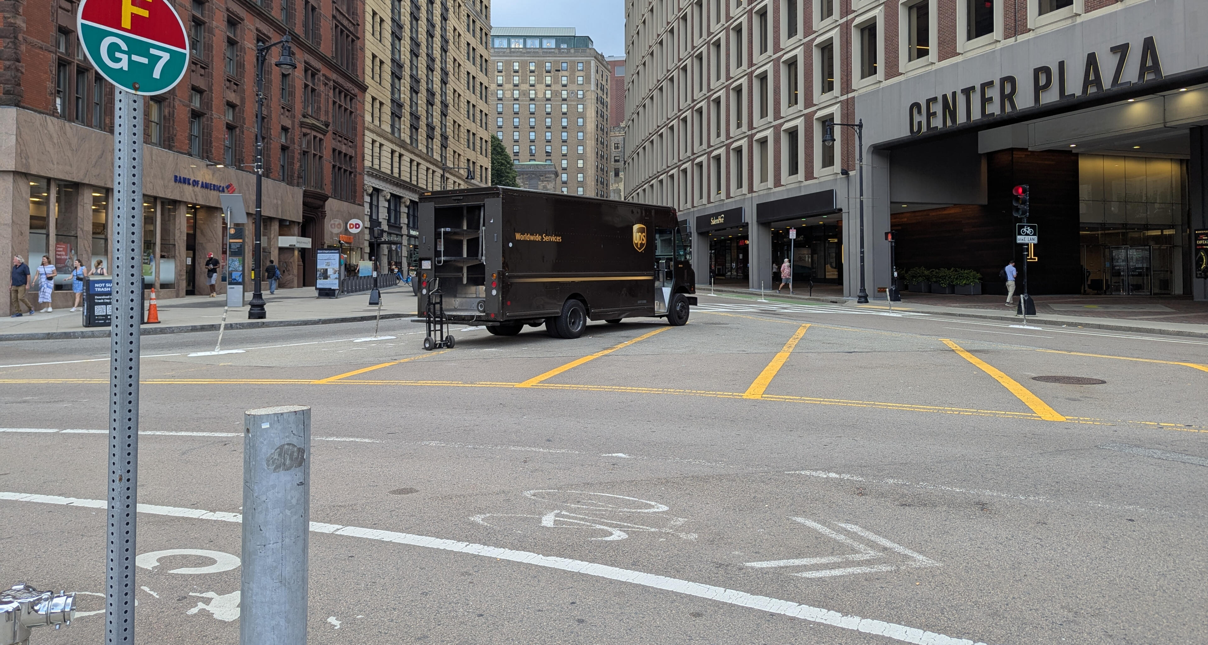
Tremont Street, Boston
The need for streetspace reallocation
When thinking about public space, we typically think of a park or a plaza. Streets, though, can be thought of as public space as well, since they typically make up most of the publicly-owned land in a city.Public space can be thought of as serving two purposes: "movement" and "place". Streets, typically, skew very far towards the "movement" side of things. However, this can change when streets are pedestrianized – removing space for cars allows for travel by other modes (i.e. walking or cycling), as well as other uses besides just transportation. The street can become a "place" in itself rather than just a way to get somewhere.In many cities, streetspace is designed almost exclusively for car travel. The below chart demonstrates that cars are only the best option for destinations that (1) attract people from farther distances and (2) don't have very many people going there at the same time. Places in cities don't usually fit this description as cities are built with higher densities, where everything is closer together.
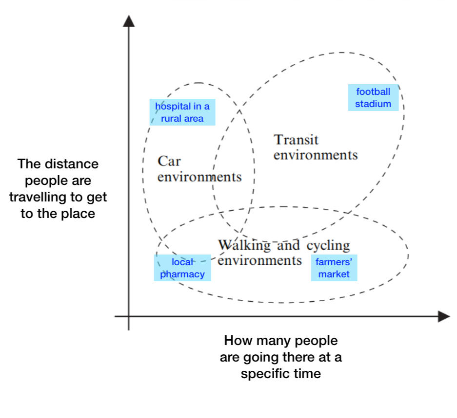
Modified chart from Bertolini & le Clercq (2003)
This is in addition to the many other negative effects from cars, like carbon emissions, risk of injury, poorer air quality, social isolation, financial costs, and so on. In a lot of cities (particularly in North America), cars have been normalized & prioritized above every other mode of transport – cars are just how everyone gets around. Overcoming this "regime" of automobility is a major challenge, as people are resistant to this type of change.
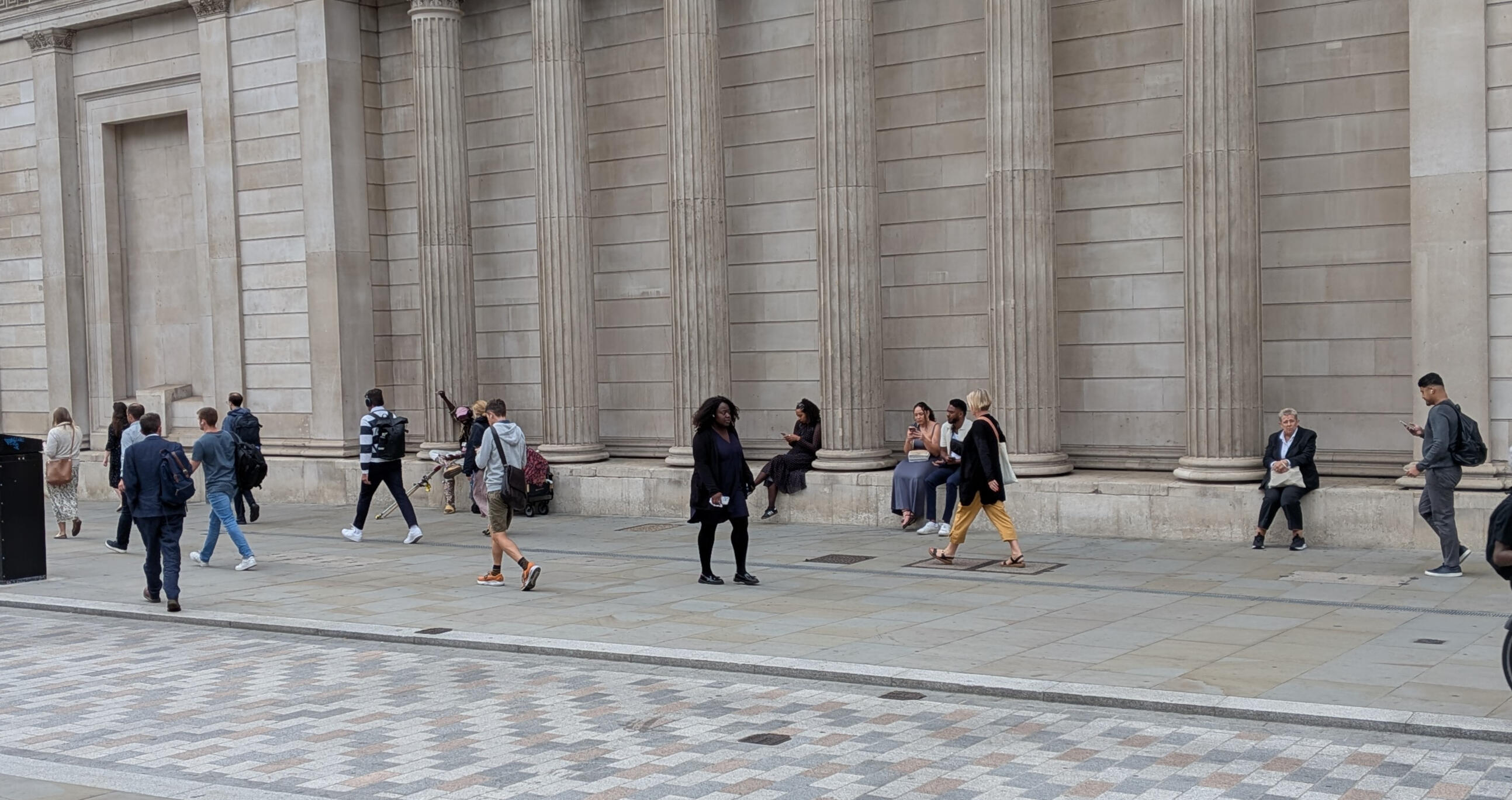
Threadneedle Street, London
The social production of space
My research used the "social production of space" as a framework to analyze pedestrianized streets. In short, this is an idea that spaces exist in different "modes":- conceived space: how planners think of the space – diagrams, schematics, etc.
- perceived space: how people in the space think of it – literally their perceptions and opinions
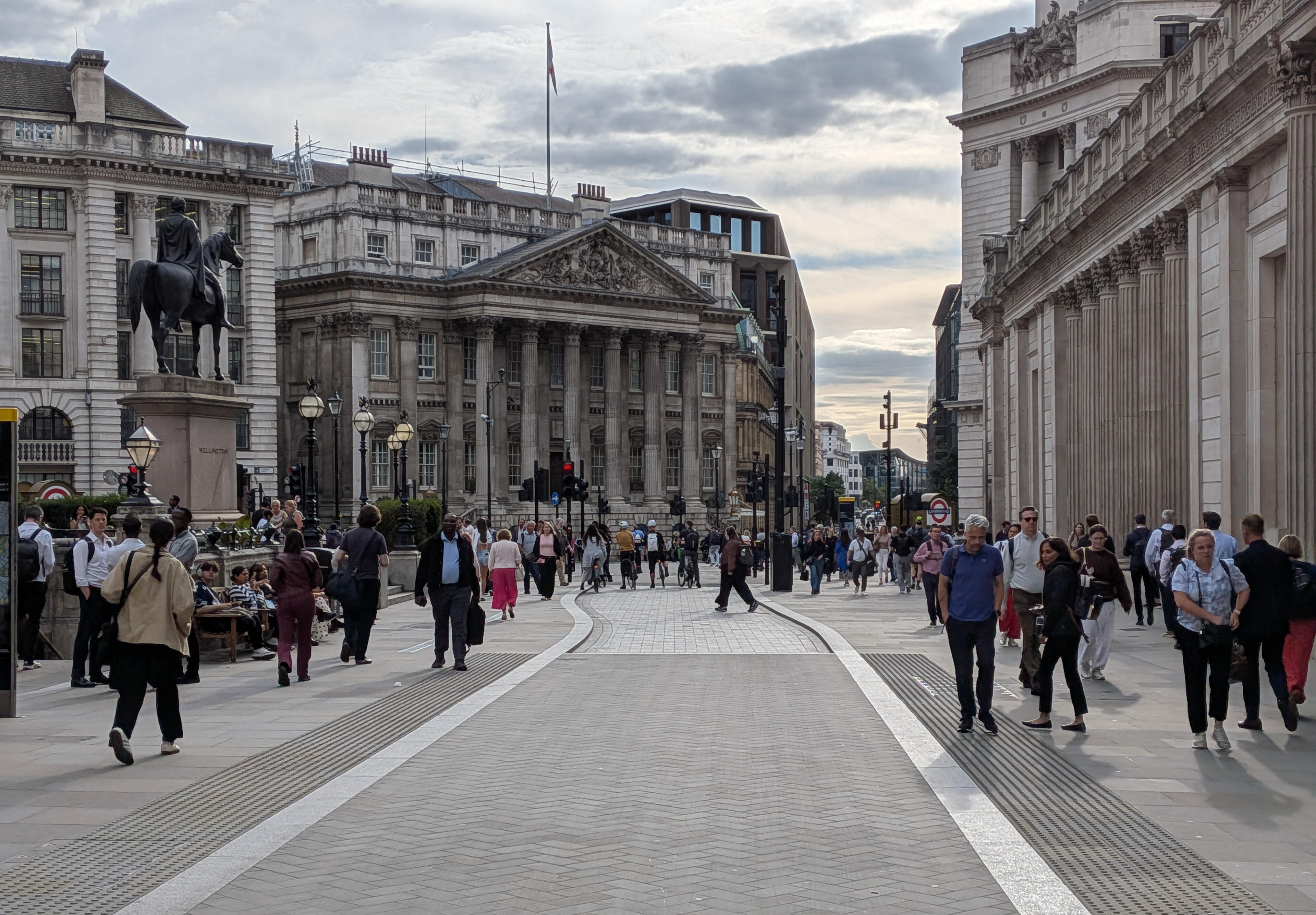
- lived space: how the space exists through all of its uses, what it means to peopleFor example, in the above photo we can see some columns along a sidewalk. The columns were likely conceived as just part of the building. However, they are also perceived by a number of people as a place to sit. Furthermore, during my research, I overheard someone in a remote meeting while sitting between these columns, so they are also a sort of workplace (an element of its "lived space"), which might not be perceivable by anyone who visits this location, or anticipated by the architects who designed the building.By comparing these three modes for a public space, more can be understood about the ways the spaces function, especially within the realm of transport, where streets are typically thought of as spaces for movement. I used four pedestrianized streets in London as case studies.
Case study locations

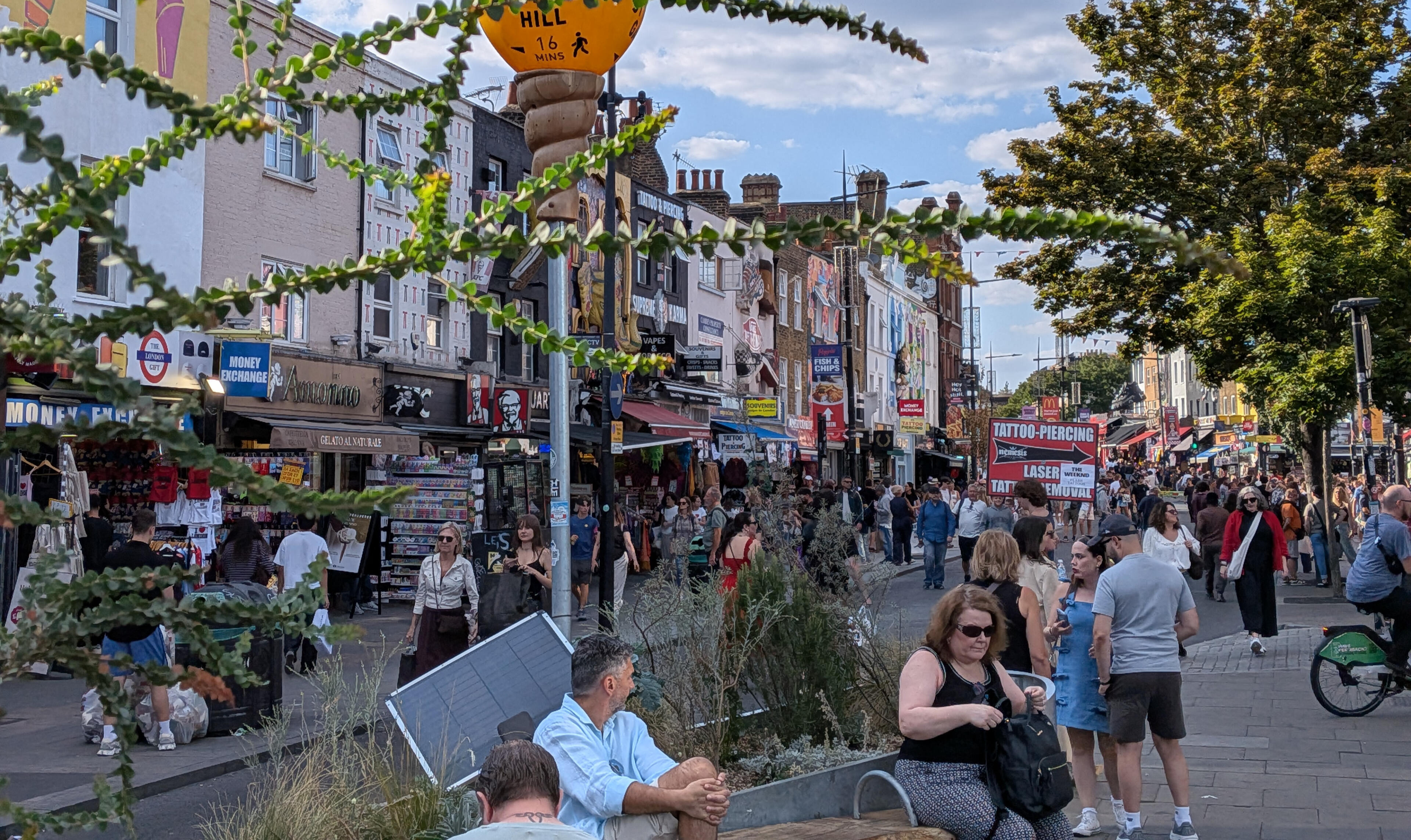
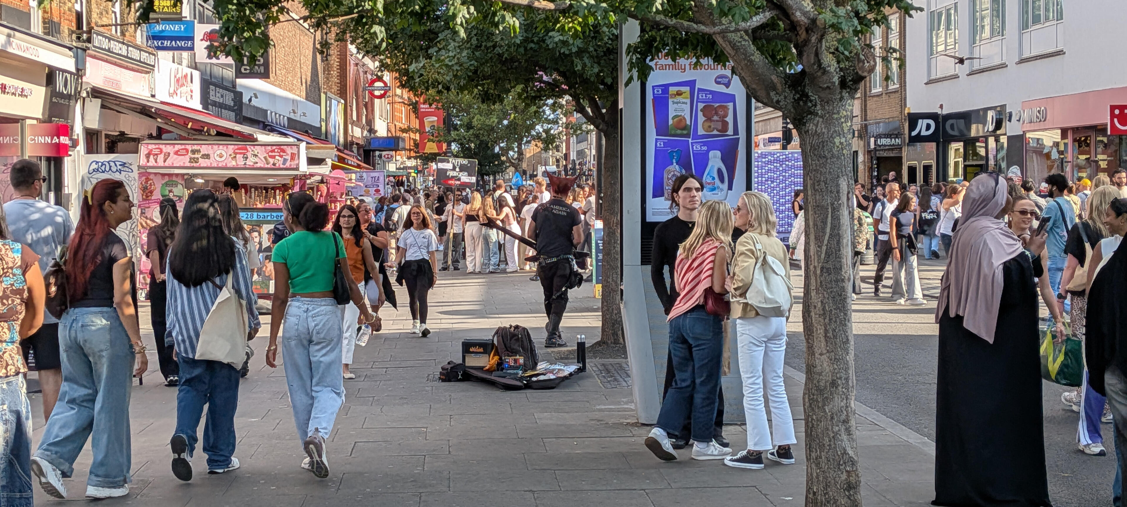
Camden High Street: a small town main street
Camden High Street is the main shopping street in Camden Town. It's known for its "goths, punks, and everything in between" but is also seen as a bit of a tourist trap.The local government saw the pedestrianization scheme as a beneficial for local businesses. This matched how people on the street saw it, as most people spoken with were tourists who specifically sought out the street as their destination – they were not just passing through.I observed the street for some time and marked down where people stopped and sat:

The "L"-shapes in the middle are benches and planters, which drew in lots of people to stop or sit. This shows the urban design concept of "edges" – people are more likely to stop near something (a bench, a tree, a building, etc.) rather than in open space. Creating these natural stopping points works with the desire mentioned above to keep Camden High Street a place where people stop and linger. The entire street is quite busy, with people handing out flyers, street performers, shops playing music, or even people recording TikToks on one occasion.In the surrounding neighborhood, the traffic impacts were minimal. Only about 1,000 of the original 5,000+ vehicles on Camden High Street were recorded on adjacent streets after the pedestrianization scheme was implemented. This means that over 80% of the traffic disappeared, a phenomenon known as traffic evaporation.
Gordon Street & Gordon Square: an outdoor hall & room
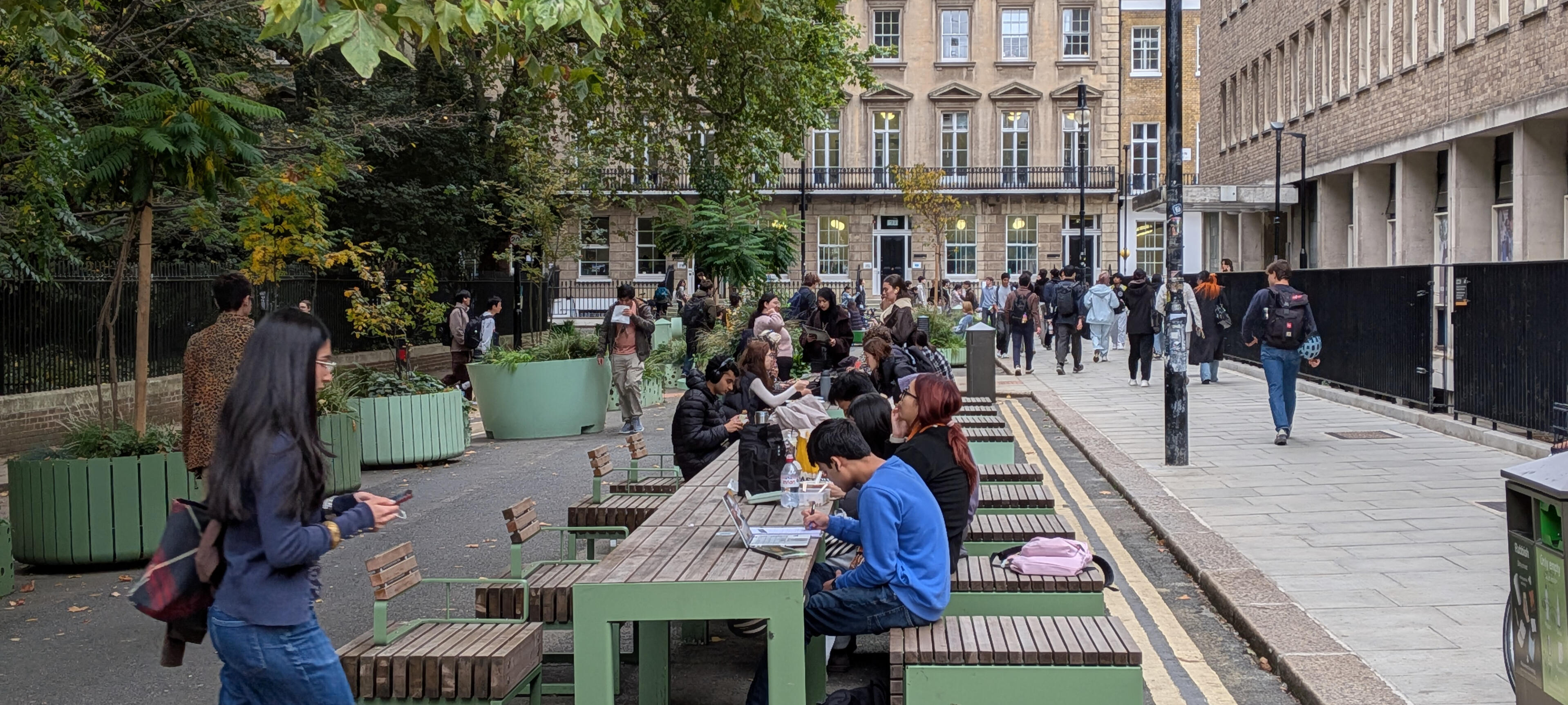
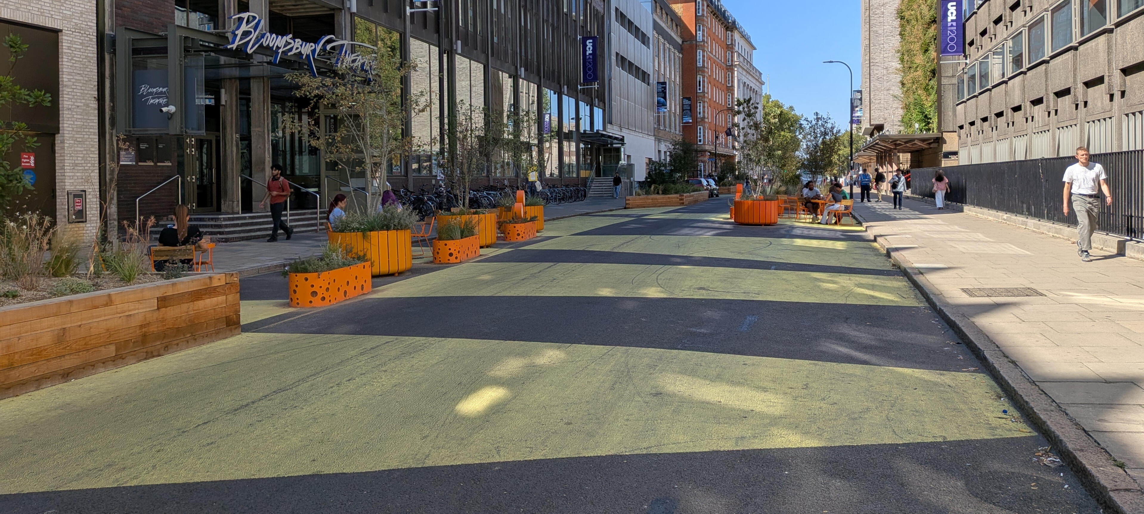
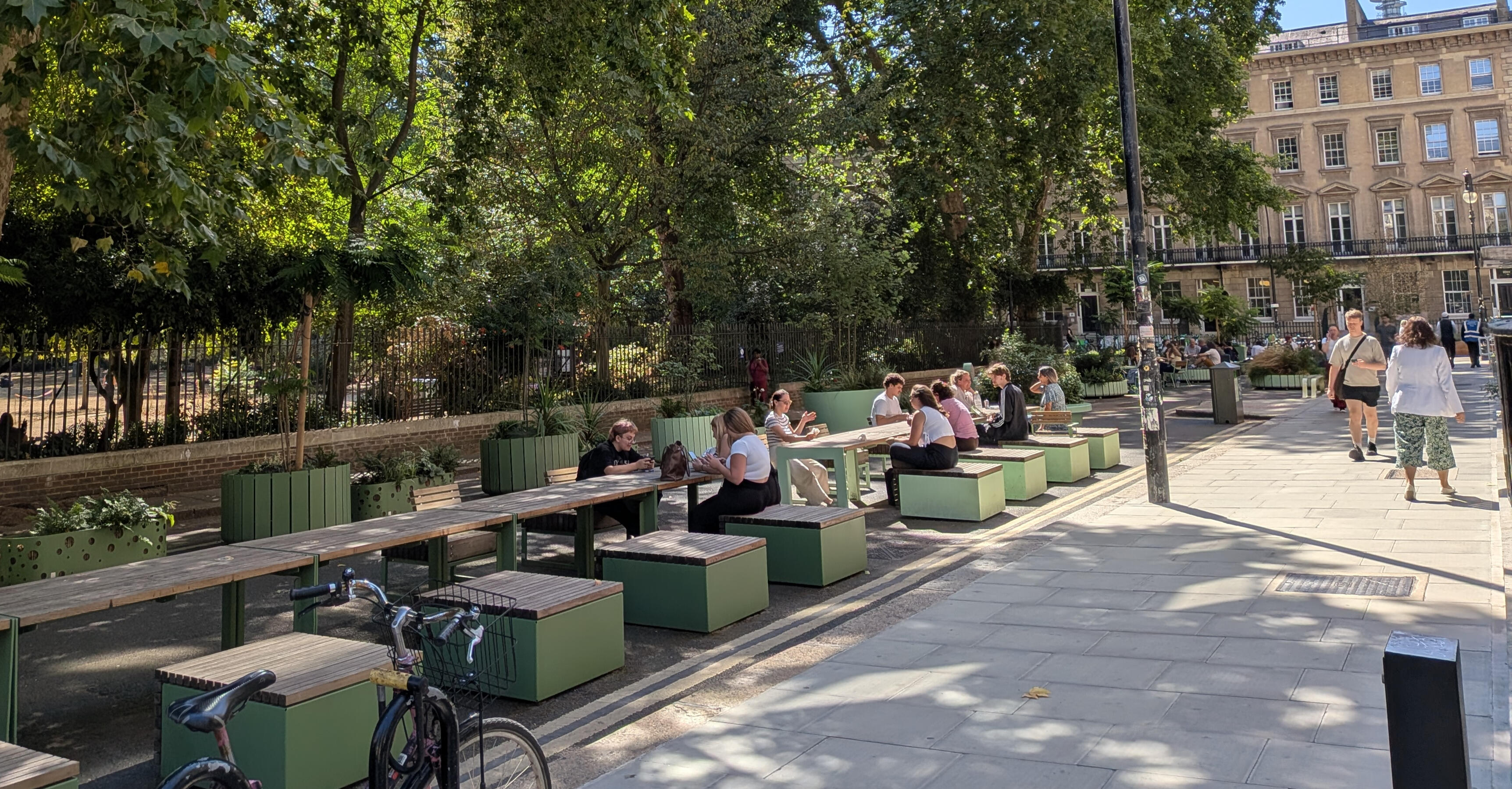
Gordon Street & Gordon Square are two intersecting streets at the UCL campus. Gordon Square is a short street with lots of plants and places to sit. Gordon Street has seating as well, but also lots of open space to accommodate for limited vehicle traffic (deliveries, emergency vehicles, etc.)
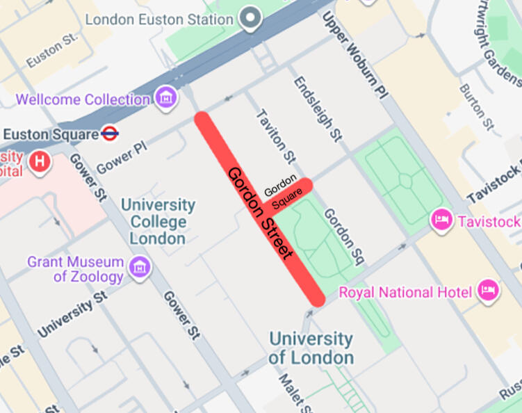
Both schemes were implemented to incentivize walking & cycling and create a better public realm. Their designs were quite different, however, as shown through the below images. Each color corresponds to a different type of use or mode of travel (i.e. red for cars, blue for pedestrians – use the arrows to flip between before & after):
Gordon Street:
Gordon Square:
There are some limitations to this type of analysis, but on a basic level it helps to show how the Gordon Square scheme created much more of a "place" in comparison to how Gordon Street continued to prioritize movement. This was evident in the perceptions from people on the street as well – most people I spoke with said they'd prefer to sit on Gordon Square, and that Gordon Street was confusing:
"I think there's not a very clear right-of-way in terms of the pedestrians or bikes...I still bike down, which I don't know if is allowed or if it's antisocial."
"I feel like I would never really choose to sit on [Gordon Street], particularly. I would probably sit over there [Gordon Square]...Because a car could basically still come through here, but a car couldn't go through there."
The differences in behavior across these two schemes was apparent from observing them. People still crossed Gordon Street on existing crosswalks and walked down its sidewalks rather than in the reclaimed streetspace, even though it was closed to car traffic. (In one 15 minute period, I counted 110 people on the sidewalks vs 9 in the street.)Seating was well-used on both streets, but Gordon Square has elements which create "enclosure" – almost like an "outdoor room", with its tables and chairs in the street. Gordon Street, conversely, is more like an "outdoor hall", where some of the room-based elements still exist, but the area as a whole is much more cavernous.
Threadneedle Street: a commercial side street
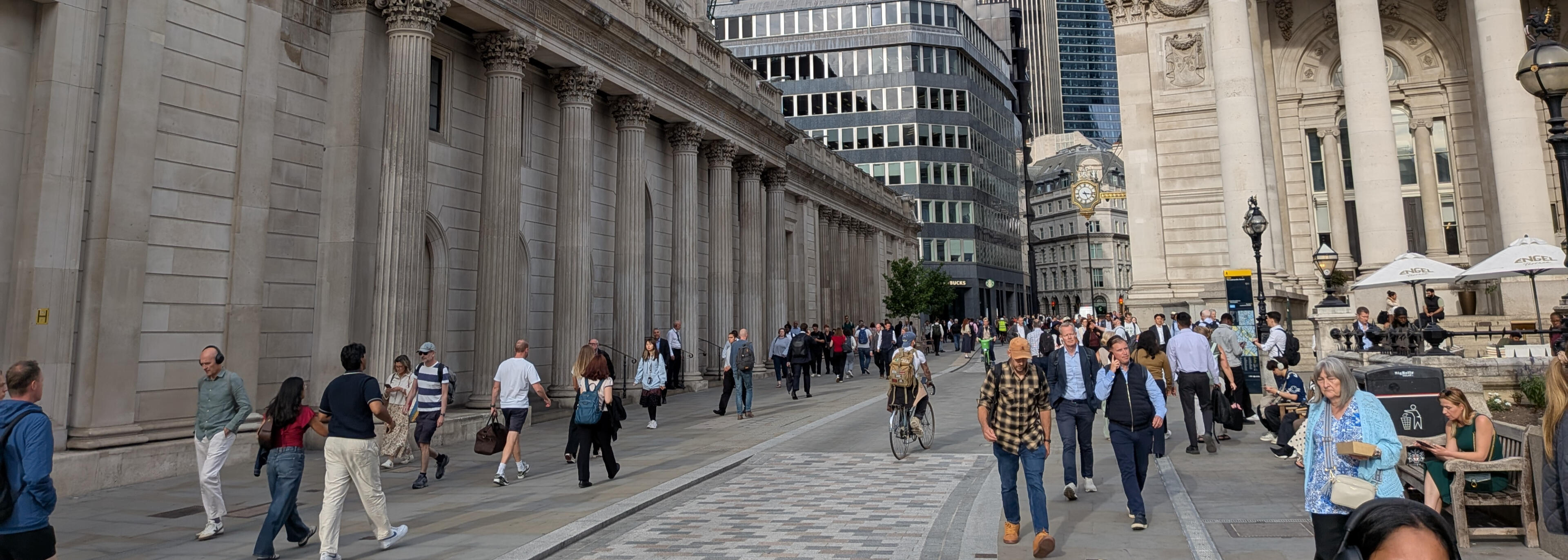
Threadneedle Street is part of Bank Junction in the City of London, a major route for commuters. A number of changes have been implemented at Bank Junction in the past decade, one of which was to pedestrianize Threadneedle Street.Road safety was the main focus of these changes in the eyes of the City, though they also mentioned wanting to make Bank into an area "to spend time in rather than to pass through".The changes are quite apparent from comparing satellite images from before and after the scheme's implementation:
In practice, Threadneedle Street is still mainly a thoroughfare for movement, albeit a pleasant one. Some people stop and linger for a while, but it's mainly used for people walking to catch the tube. A remarkable 1,267 people were counted passing by in 10 minutes during rush hour – at this rate, over 7,500 would pass through the street in an hour, easily eclipsing the number of vehicles nearby streets would see in an entire day. Clearly, the street is a major part of the area's transport infrastructure.Interviews on the street reflected this use, as most people just said the street was "nice" and that they would have passed through regardless. There is an evident desire for more of a "place", though, as people were observed sitting wherever it was possible (e.g. the aforementioned columns).In sum, the street's use matches how it was designed: it moves commuters safely. It functions as a "commercial side street", connecting people to other streets or forms of transport.
Hammersmith Bridge: a pedestrian parkway
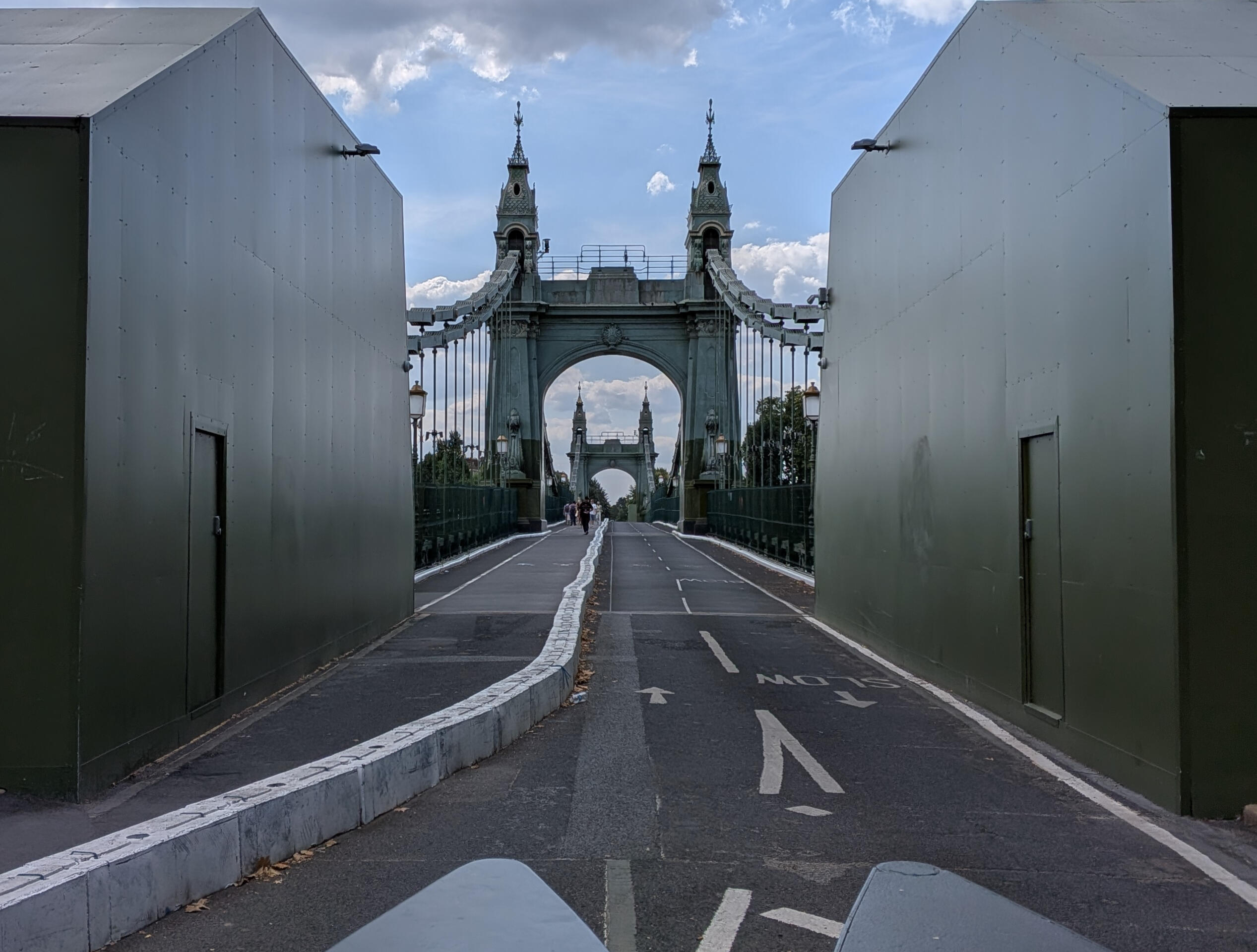
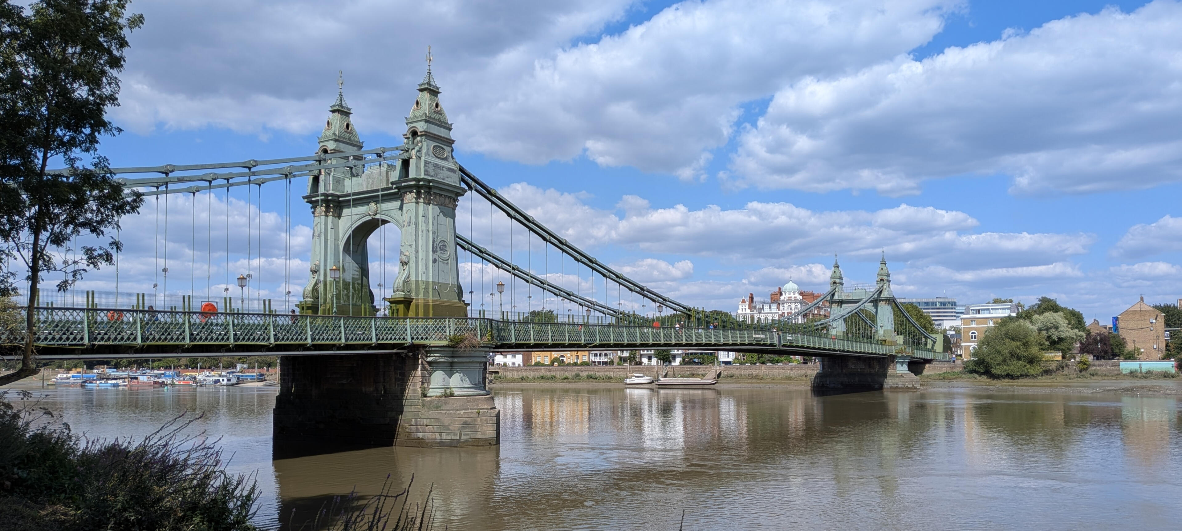
Hammersmith Bridge connects two boroughs in London over the River Thames. The 130-year-old bridge closed to vehicle traffic in 2019 due to structural issues. Due to spiraling repair estimates (>£300M or US$400M), there is no current plan to reopen it to cars.The entity responsible for the bridge, Hammersmith & Fulham Council, continued to think of it only as a road for cars until doing so became financially untenable. They didn't particularly want to pedestrianize it, but eventually cycling and walking became the only things the bridge could (literally) support.This was reflected in how people in the area thought of the bridge. While people liked the bridge's history and views, almost no one actually stopped on the bridge or sought it out as a destination, as it isn't really set up for that.Multiple people interviewed said they preferred the bridge without cars but were unsure on whether it should stay like that due to perceived negative traffic impacts:
"I have a lot of empathy for people on [the southern] side of the bridge."
"I selfishly kind of hope that they'll never let cars back on this bridge."
"I'm not convinced it would be better with cars going down it, but there would be convenience."
Hammersmith Bridge was the only location in my research where people were ambivalent or against the pedestrianization scheme – everyone at the other three locations was in favor. A main sticking point for this group of people is traffic at Putney Bridge, a parallel crossing of the Thames a few kilometers down the river. However, traffic at Putney & all nearby bridges is actually lower now than it was before Hammersmith Bridge closed to vehicles:
| Bridge | 2018 | 2025 | Change | % of 2018 H'smith Traffic |
|---|---|---|---|---|
| Hammersmith | 22,363 | 0 | -22,363 | -100% |
| Putney | 42,498 | 37,089 | -5,409 | -24.2% |
| Chiswick | 34,753 | 31,024 | -3,729 | -16.7% |
| Kew | 33,617 | 32,816 | -801 | -3.6% |
| Wandsworth | 47,931 | 36,853 | -11,078 | -49.5% |
| Twickenham | 47,451 | 39,483 | -7,968 | -35.6% |
| Battersea | 26,175 | 23,345 | -2,830 | -12.7% |
| Total | 254,788 | 200,610 | -54,178 | -242.3% |
This data shows a remarkable amount of traffic evaporation: not only did the 22,363 vehicles from Hammersmith Bridge not get diverted onto other bridges, but an additional 30,000 vehicles also disappeared as well. This aligns with existing research showing that closing "strategic links" leads to the greatest reduction in car travel.I characterized Hammersmith Bridge as a "pedestrian parkway", as it has pleasant views and close proximity to nature, but doesn't take advantage of this as it prioritizes movement from one side of the river to the other.
Södergatan, Malmö
Conclusions
These four pedestrianized streets do not all have the same effects. Although the reasons given by their planners were similar (e.g. enabling walking & cycling, creating a better public realm), there was variation in the schemes' planning and how they were perceived. Pedestrianization in general is seen quite positively, but the schemes that leaned more heavily towards creating a "place" were perceived the best. The more "movement"-based schemes didn't allow for the diverse activities that took place on the other streets.More broadly, it was apparent that the existing context of a street is a major factor. Most of these schemes how enhanced the street was already understood:- Camden High Street was already seen as a tourist destination
- Gordon Street/Square was already part of the UCL campus
- Threadneedle Street was already a busy street for commutersHammersmith Bridge, however, changed its context by no longer primarily being a link for cars. This is perhaps why its reception was more controversial. The new design also didn't really capitalize on the existing elements of the bridge that people liked: proximity to nature, the river views, the historic nature of the bridge. People tend to judge spaces on the perceived change in quality rather than any absolute level of quality, so creating a higher-quality space could have affected public opinion.
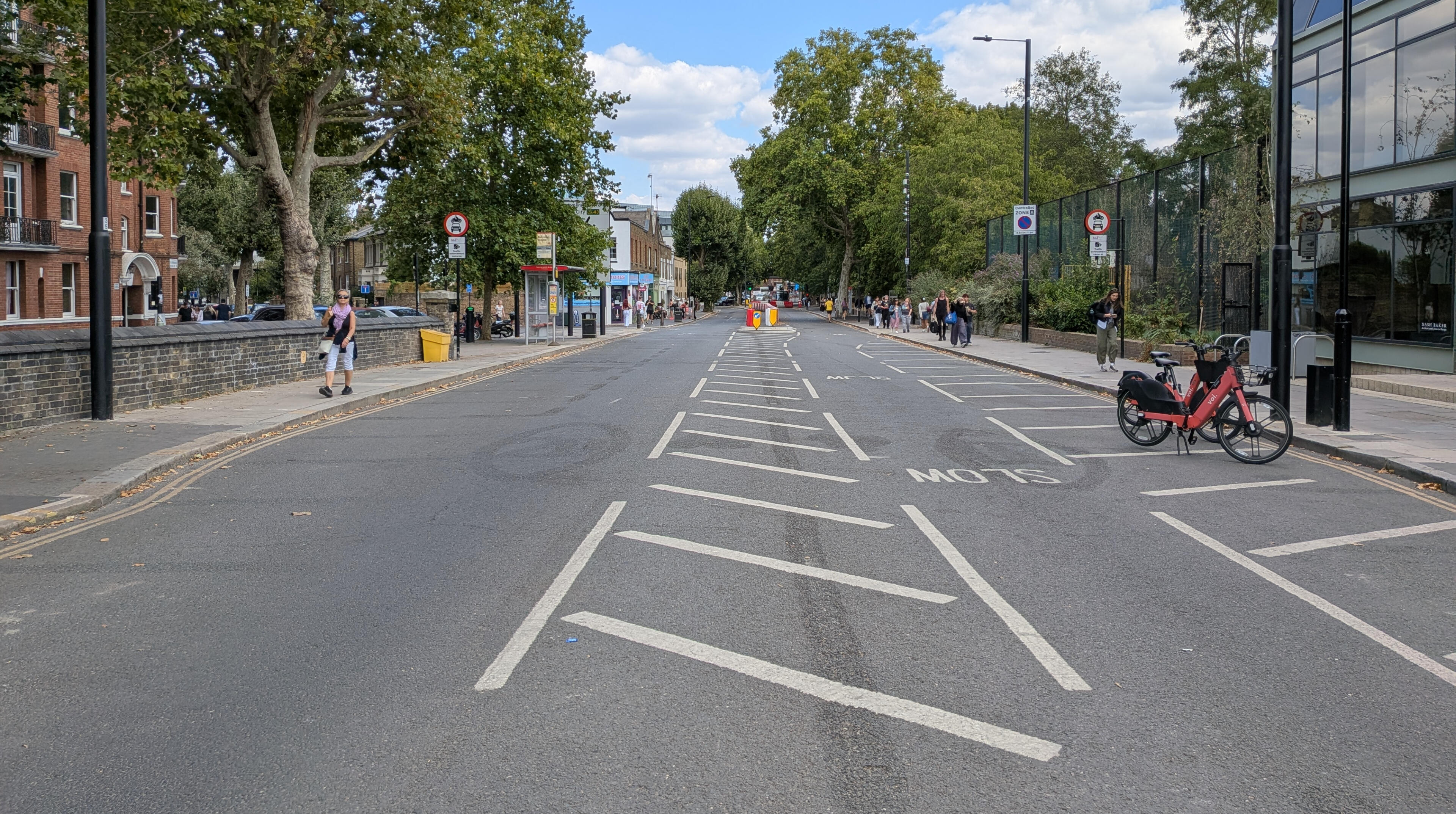
A pedestrianized area by the northern end of Hammersmith Bridge.
All in all, this research aimed to show that streetspace reallocation is complex and should not be seen as a monolith within transport or urban planning. There are lots of different forms it can take, with pedestrianization as just one of many options (e.g. bike or bus lanes, outdoor seating, school streets, etc.) – each scheme's effects will be different. Transport planners may benefit from research in this vein, as they could better understand which goals are likely to succeed, which aspects are received positively, and which options might face the most resistance. A general takeaway for anyone reading this could be to simply think about streetspace as public space and consider all the different uses it could have instead of just moving cars.
Rue Charles Baudelaire, Paris